 Source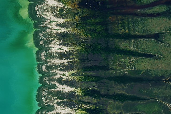
Bountiful Roebuck Bay
Roebuck Bay in Western Australia's Kimberley region is a productive bay defined by significant tidal ranges and monsoonal seasonal shifts.
Why it matters
The area's high productivity supports critical marine nurseries and serves as an essential stopover for hundreds of thousands of migratory birds.
The details
- Tidal range can reach 9 meters due to a shallow continental shelf.
- Mangrove forests expand westward by nearly 2 meters per year.
- Shells and snails can reach abundance of 2,500 per square meter.
Show entities and relationshipsHide entities and relationships
In this article
Topics
Organizations
Technologies
Countries
Key connections
Landsat 8 uses Remote Sensing
Landsat 8 uses remote sensing technology to collect Earth surface observations
Landsat 9 uses Satellite Observation
Landsat 9 uses satellite observation technology to monitor Earth land and coastal areas
OLI is built with Remote Sensing
OLI is built with remote sensing instrument technology for Landsat satellites
Landsat 8 is related to Australia
Captured satellite imagery of Roebuck Bay in Western Australia
Landsat 9 is related to Australia
Captured satellite imagery of Roebuck Bay throughout 2026
Australian Government is related to Australia
Provided ecological abundance statistics for Roebuck Bay marine life in Western Australia
Related events
Landsat 8 Captures High-Tide Imagery of Roebuck Bay
Get the weekly recap
The stories like this one, picked and explained — once a week, straight to your inbox.